Troubled Geographies:
Two centuries of Religious Division in Ireland
|
Troubled Geographies:
|
|
| Home | Summary | Publications | Social Explorer | Acknowledgements | |
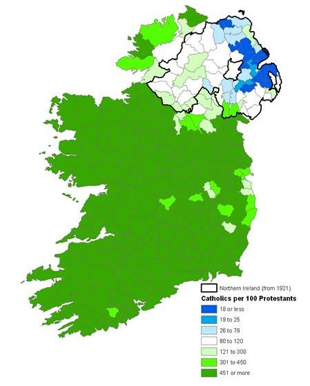
The interactive mapping used on this site is based on Social Explorer developed by Prof. Andrew Beveridge and Ahmed Lacevic at the City University of New York. Social Explorer is is a web-based application that creates fast, intuitive, and visually appealing maps and reports. The software gives anyone with an internet connection access to census data that was previously only in the domain of academic experts. In 2010 it was given an award for Outstanding Reference Source for 2010 by the Reference and User Services Association (RUSA) a division of the American Library Association. The
An overview of the Social Explorer maps of Ireland is available from here: http://www.socialexplorer.com/pub/maps/map3.aspx?g=205 For more information on Social Explorer see: socialexplorer.org.
|
|||||
|
|
|
|
|